Modelling important areas for breeding waders as a tool to target conservation and minimise conflicts with land use change

Upland afforestation Scotland by John Calladine

Author(s): Calladine, J., Border, J., O’Connell, P. & Wilson, M.

Published: September 2022  

Journal: Journal for Nature Conservation

Digital Identifier No. (DOI): https://doi.org/10.1016/j.jnc.2022.126267

View journal article

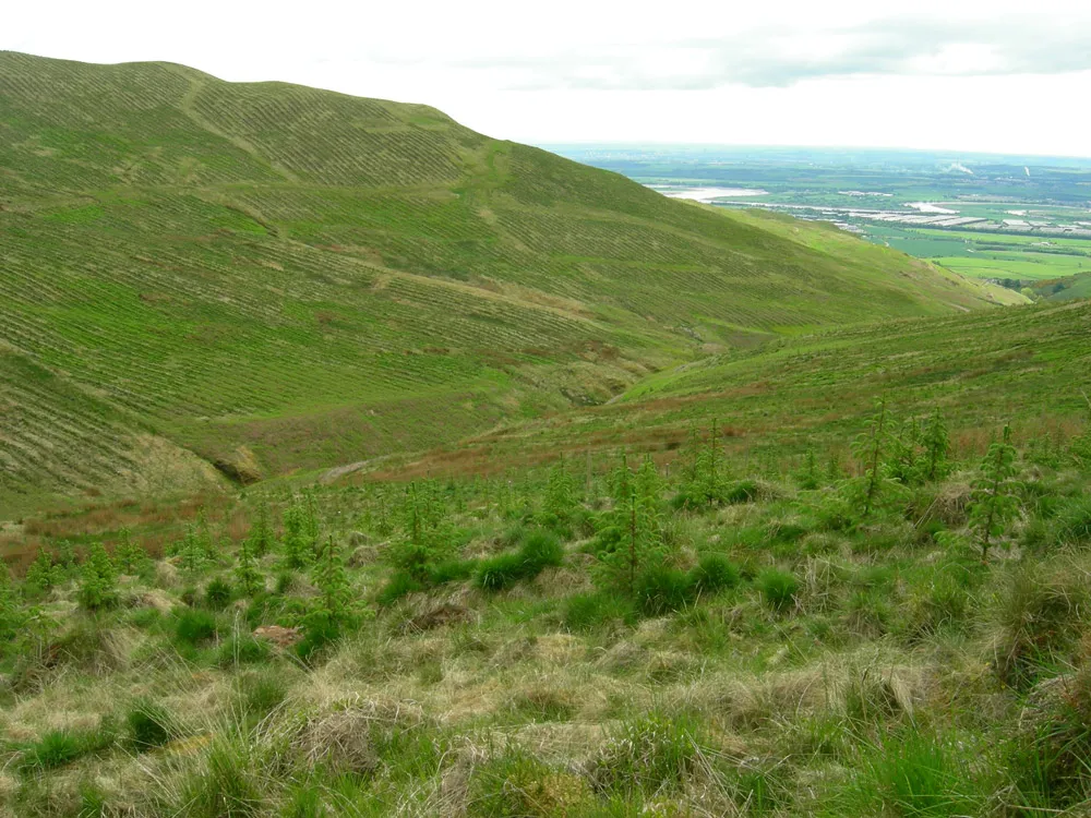
The future of Britain’s breeding wader populations depends on land use policy and local management decisions, both of which require robust evidence and appropriate tools if they are to support the conservation of these priority species. One of the biggest challenges has been the geographical scale at which national data on wader abundance and distribution are available. These data are coarse in their resolution, making them poorly suited to directing conservation initiatives or informing land management decisions at a local scale. But can a statistical approach produce high-resolution maps of predicted wader abundance that are sufficiently accurate to be used for decision-making?

Abstract

Breeding waders are high profile species of conservation concern because of their declining populations. Their future depends on the outcomes of land-use policy and local management decisions. However, the low spatial resolution of extensive data on wader occurrence is poorly suited to directing conservation initiatives or to minimising detrimental impacts arising from land-use changes such as forest expansion. We used statistical models to produce high-resolution maps of predicted wader abundance in Britain and tested whether these were sufficiently accurate to be used for decision making. Random forest regression trees were developed using Bird Atlas data modelled with a range of environmental data sets to predict the relative abundances of ten species of breeding wader across Britain at 1-km square resolution. Similar analytical frameworks could usefully be applied in other geographical areas.

Correlations with Bird Atlas metrics and other independent data indicate that these predictive models worked best for Curlew Numenius arquata and Oystercatcher Haematopus ostralegus.  Model performance was poorer for species with more restricted distributions and/or habitat requirements, such as Greenshank Tringa nebularia and Ringed Plover Charadrius hiaticula. The precision of model predictions was also limited by the rescaling of data to 1-km square resolution.

To facilitate practical and consistent interpretation by stakeholders influencing the status of breeding waders, model outputs were categorised into five discrete strata of relative abundance. These strata were used to produce sensitivity maps (available at https://app.bto.org/wader-map/), primarily to inform high-level policy decisions. The model outputs were also used to investigate broad-scale associations of breeding wader distribution with landscapes and land uses. These show that high proportions of populations (relative to their extent) are supported by areas with comparatively low predation risk (e.g. islands and grouse moors) and also by nature reserves. At more local scales, the sensitivity maps can be used to help decide on the levels of scrutiny required to assess development proposals (e.g. for establishment of new tree planting).

The impacts of changing land use on our breeding wader populations can be seen in the long-term declines evident in the monitoring data collected by BTO for species such as Curlew, Redshank, Lapwing and Oystercatcher. The intensification of agriculture, land drainage, forest expansion, and increased impacts of predation have all been implicated in these declines. Of these, forest expansion arguably poses the greatest risk to breeding waders.

Since the middle of the 20th century, the rate of forest expansion in Britain has been high, and it is likely to remain a priority for UK governments over the coming decades, contributing as it does towards a drive for net-zero carbon and also to the conservation of woodland birds. Forests, however, can impact negatively on breeding waders by reducing and fragmenting the open habitats in which they breed, and by reducing breeding success due to the activities of woodland-associated predators, such as Red Fox and Carrion Crow. Improvements to our understanding of breeding wader distributions, as well as to the ease with which such information can be accessed by the relevant stakeholders, will help to target wader conservation and minimise negative impacts of forest expansion and other types of development.

Tools that can be used by stakeholders to identify the risks and opportunities for waders require detailed knowledge of their distributions. This can be achieved locally through bespoke surveys, but this approach becomes less practical at larger scales, such as would be required to inform national land use strategies. Where the appropriate datasets exist, large-scale knowledge of species distributions can be achieved by modelling the relationships that exist between the abundance of a species and the various environmental variables that influence this. By using data from Bird Atlas 2007-11 alongside environmental datasets, including those on climate, habitat and topography, BTO researchers were able to model the predicted relative abundances of breeding waders at a 1-km square resolution across the whole of Britain.

The resulting relative abundance values were then compared with several independent datasets, including the BTO/JNCC/RSPB Breeding Bird Survey, to determine whether they were robust. The models worked best for Curlew and Oystercatcher but were less good for species with more restricted distributions and/or habitat requirements, such as Greenshank and Ringed Plover. The abundance values were then placed in one of five strata and used to produce sensitivity maps, primarily to inform high-level policy decisions.

The outputs were also used to investigate broad-scale associations of breeding wader distribution with landscapes and land uses. These reveal that high proportions of populations (relative to their extent) are supported by areas with comparatively low predation risk (e.g. islands and grouse moors) and also by nature reserves. At more local scales, the sensitivity maps can be used to help decide on the levels of scrutiny required to assess development proposals (e.g. establishment of new tree planting schemes). The approach adopted underlines the potential for BTO’s large scale datasets to enable the development of policy tools that can support decision-making at both the national and local scales, leading to the best outcome for birds and people.

Notes

The work was funded by Forestry Commission England (Neil Riddle as nominated officer), the Cairngorms National Park Authority, Scottish Forestry and RSPB (Pete Mayhew as nominated officer) and Scottish Natural Heritage (SNH) through the Working for Waders partnership. The analyses draw heavily on earlier work funded by Scottish Forestry (Colin Edwards as nominated officer) and by the Joint Nature Conservation Committee (JNCC). Bird Atlases were a partnership between BTO, the Scottish Ornithologists’ Club and Birdwatch Ireland and BBS between BTO, JNCC and RSPB; we are indebted to the many volunteers who contributed to the fieldwork. Other data has been provided by the Shetland Biodiversity Records Centre (Paul Harvey), RSPB (Allan Perkins, Robin Sinclair) and Natural England (Allan Drewitt). Many others have contributed to discussions guiding this work: Mark Broadmeadow and Jim O’Neill (Forestry Commission England); David Hetherington, Will Boyd-Wallis and Mike Cottam (CNPA); Allan Drewitt, Adrian Jowitt and Robert Cussen (Natural England); Jess Findlay, Alastair McGugan and Jeanette Hall (SNH), Allan Perkins,  Chris Bailey, Paul Bellamy, Dan Tomes, Alison Phillip, David Douglas and Duncan Orr-Ewing (RSPB), Scott Newey (JHI), Ross McLeod (GWCT), Andy Tharme (Scottish Borders Council); Sam Franks, Rachel Taylor, James Pearce-Higgins, David Jarrett, Chris Wernham (BTO).

Staff Author(s)
Publication Topics


Related content