Introducing BirdTrack Home
BirdTrack Home
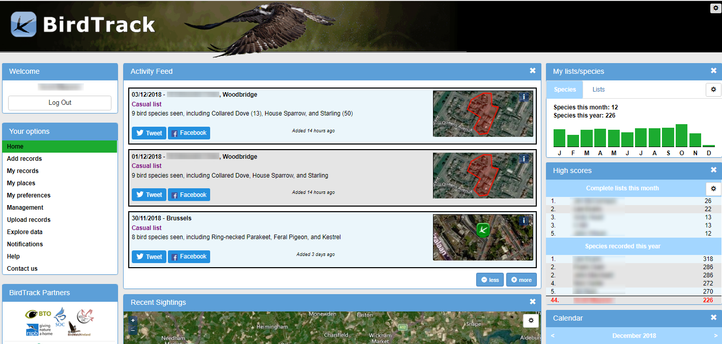
Your records form the central elements of the page with the activity feed showing a summary of the last visits you made. Explore the map to find out what has been seen locally or to visualise the relative frequency of records of any species across Britain and Ireland. Discover the latest reporting rates (the percentage of complete lists that contain each species) using the interactive graphing facility.
All the tools to add and interact with your own records are available directly from the landing page. Simply login – or register if you are new to BirdTrack – using the button at the top left of the page to activate the recording options.
How do I stop my name from appearing?
If you give permission for your name to appear but change your mind later, you can opt to keep your records anonymous via the tickbox in My preferences. Changing anonymity settings may take up to 24 hours to update through the system.
How long does it take for updates to appear?
- The data being used to draw the graphs are updated every 20 minutes.
- The records/data being used to populate the maps are updated every 30 minutes, between 6am and 10pm only.
- Changes to permissions / display name settings are updated nightly.
These restrictions are necessary to minimise the demand on the database and ensure that BirdTrack continues working as fast as possible for everyone.
I noticed a record on the map that is sensitive or doubtful – what should I do?
The publicising of BirdTrack records will continue to follow guidance from the Rare Breeding Bird Panel to ensure that records of sensitive species are shown only at an appropriate resolution. Users also have the option to mark records as sensitive, if there is a particular reason that they should not be displayed.
The records displayed on the map will not necessarily have been verified by local recorders. Whilst there are date, count and local rarity warnings in place to alert observers if they enter an unusual record, some questionable records may still appear on the map.
If you spot a potentially sensitive record that has ‘slipped through the net’, or a record that you think is doubtful, please email details of the species, date and location to birdtrack [at] bto.org.
How are improvements funded, and will there be more changes to BirdTrack in the future?
Developments were made possible through donations from a small number of very generous members of the existing BirdTrack community, to whom we are extremely grateful.
There is a modest annual budget for developing BirdTrack. We are committed to continuing to improve the system for birders, local bird recorders and anyone else who is interested in the outputs BirdTrack offers. We have a long and diverse ‘shopping list’ of changes we’d like to make when time/resources allow but if you have any specific suggestions for improvements, please do let us know.








Share this page