Breeding Waders of Wet Meadows

Help us monitor the long-term population changes of our lowland breeding waders in England and Wales.
This survey will continue in spring 2022 following on from the main 2021 survey, to help fill important gaps in our coverage. The aim will be to cover new sites in 2022, to increase the coverage achieved in 2021, so repeat visits to 2021 sites are not required.
How to take part
View available sites in the map below.
If a site is available locally, sign-up for the survey to request it.
Signing-up
- Have a BTO account? Log-in at www.bto.org/my-bto and then sign-up to the survey.
- Don't have a BTO account? Register a new account and then sign-up to the survey.
Once logged-in, you can also find the survey sign-up for BWWM under 'Sign Up for Projects' at www.bto.org/my-bto.
Request a site
Once signed-up, you can request a site via the survey application. Log-in to the survey application using your BTO account details.
Why lowland waders of wet meadows?
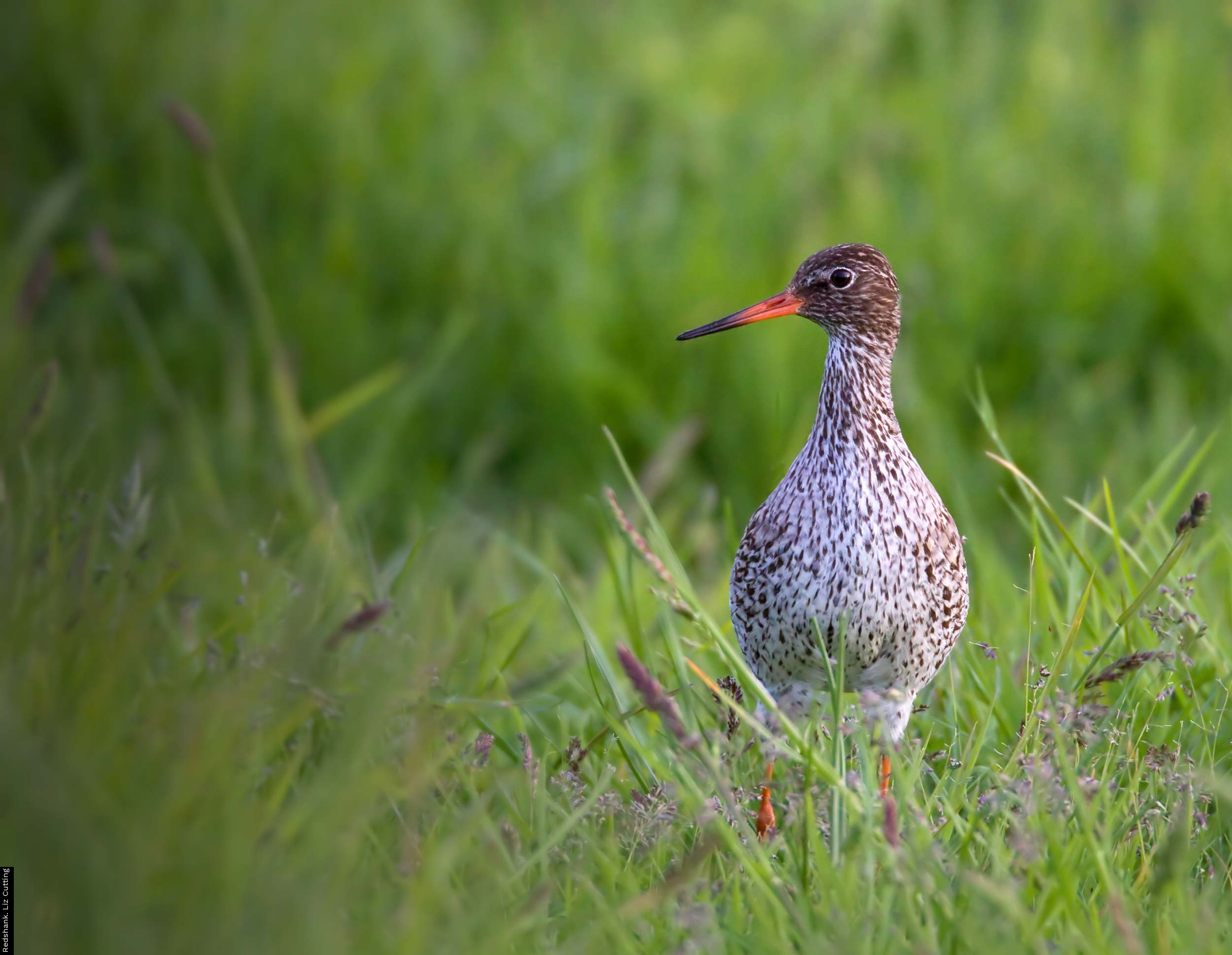
The purpose of this survey is to assess the importance of both existing and new lowland wet grassland and also other breeding wader habitats in England (as provided by agri-environment schemes) for declining breeding birds such as Curlew, Lapwing, Redshank and Snipe.
The survey will re-visit sites from the 1982 and 2002 surveys, including sites from the 2009-10 RSPB targeted areas, as well as other new sites. Surveys conducted in Wales will focus on sites from the 2002.
What’s required?
The survey will require three daytime visits, with at least one week separating each, and a single dusk visit for Snipe during May - only if present at the site. An April visit should be made to detect Lapwing, and morning survey visits are preferable. Surveyors will need to be able to identify common wader species and be familiar with display and territorial behaviour.
Historic wader sites as well as newly created/managed farmland wader habitat, including arable Lapwing Plots will be covered. Simple habitat and land management measures will also be recorded. All regions of lowland England will be covered, as well as Welsh sites that were covered in 2002.
All survey forms and documents can be downloaded from the Resources page and a site map with numbered fields can be downloaded and printed from your site list, once allocated. Plot all waders in each field on the downloaded maps provided using standard BTO species codes.
Ducks should also be recorded and we are also keen to use the opportunity to record Yellow Wagtail and Meadow Pipit. Only wader species need to be mapped.
Time / Skill Required
Project timeline, contributions & findings
Project timeline
- 14th to 30th April – 1st Visit
- 1st to 21st May – 2nd visit
- 22nd May to 24th June – 3rd visit
- 1st to 31st May – Optional 4th evening Snipe visit (only sites with likely Snipe occupation)
This survey is organised in partnership with RSPB and commissioned by Natural England. For more information, contact survey organisers: David Norfolk and Greg Conway. Email: breedingwaderswm2 [at] bto.org

Share this page