Defining your sites in the global portal
10 May 2018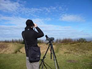
The global portal, soon to be the standard BirdTrack portal, offers three tools to define your birdwatching sites: Polygons, Paths and Points. The polygon tool allows you to draw an outline of a site, which can be useful for irregularly shaped or large sites. As the name suggests, the path tool allows you to draw a line or path. Finally, the point tool can be useful to mark sites which involve stationary observation, for example seawatching sites.
Using these tools is especially useful where sites overlap Ordnance Survey grid reference boundaries. Full instructions on how to use each of these three tools can be found on our help pages.






Share this page