Polygons in BirdTrack
12 Dec 2017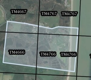
One of the more frequent questions we receive is in relation to how to create sites which overlap Ordnance Survey (OS) grid square boundaries. The easiest solution to this is to use the polygon tool available on the global data entry portal to outline your site. If you are unfamiliar with using polygons, there is a handy tutorial video on our help page.
Since Bird Atlas 2007–11 ended, we've placed less emphasis on BirdTrack sites needing to fit entirely within OS grid squares. However, drawing the outline of your sites gives valuable extra information for anyone analysing the data. Also, please do give your sites informative names to help with validation.












Share this page